
Gulf Coast Ecosystem Restoration Partnership Five-Year Report
Working with Private Landowners to Advance Gulf Restoration Goals
Download a PDF version of this report here.
Private land makes up 86 percent of the land area of the five Gulf coast states. In the Gulf region, private landowners in general, and farmers and ranchers in particular, are essential partners in conserving natural resources. NFWF and NRCS have a long history of jointly supporting private lands conservation in the Gulf. Immediately after the Deepwater Horizon oil spill in 2010, for example, NFWF was a founding partner in NRCS’ Migratory Bird Habitat Initiative (MBHI). MBHI was launched with $4 million in capacity funds from NFWF and $40 million for restoration from NRCS. Through partnerships with numerous organizations, MBHI rapidly created over 500,000 acres of temporary or permanent stopover and overwintering wetlands, reducing migratory birds’ reliance on oiled habitats and bolstering their populations.
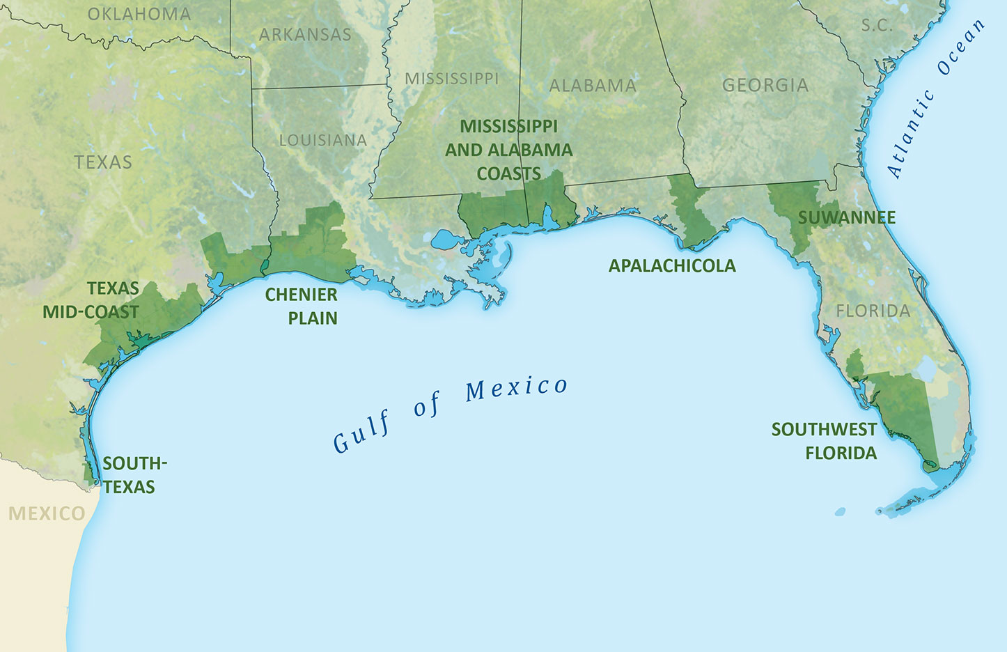
| The Gulf Coast Ecosystem Restoration Partnership between the U.S. Department of Agriculture’s Natural Resources Conservation Service (NRCS) and the National Fish and Wildlife Foundation (NFWF) was launched in 2014 to support voluntary, incentive-based private lands conservation in seven priority Gulf Coast landscapes. Each partner has committed $50 million, for a planned total impact of more than $100 million. |
NFWF and NRCS launched the Gulf Coast Ecosystem Restoration Partnership in late 2014 to build on their successful history together. The Partnership was designed to leverage NFWF’s then-newly established Gulf Environmental Benefit Fund (GEBF) and to accelerate Gulf Coast private lands conservation. The Partnership is focused on conserving land, improving water quality, and restoring wetlands, while at the same time sustaining agricultural production across the region. NFWF and NRCS are using their respective authorities – the GEBF as well as the Environmental Quality Incentives Program (EQIP) and the Agricultural Conservation Easement Program (ACEP) – to support complementary projects, the synergies of which will leave lasting conservation legacies in priority landscapes across the five Gulf States.
250,000+Acres being restored, enhanced or protected, over half of which are wetlands* |
15,000+Acres being enrolled in new perpetual conservation easements* |
800Cooperating landowners* |
| Landscape | NFWF Funding | NRCS Funding | Total Partnership | Other |
| South Texas (Bahia Grande) | $4,727,514 | - | $4,727,514 | $22,321,282 |
| Texas Mid-Coast | $6,951,957 | $2,842,056 | $9,794,013 | $50,227,385 |
| Chenier Plain (TX and LA) | $9,896,980 | $4,618,900 | $14,515,880 | $21,817666 |
| Coastal Counties (MS and AL) | $9,168,039 | $11,674,776 | $20,842,815 | $9,609,695 |
| Apalachicola and Suwannee Watersheds (FL) | $250,000 | $2,680,000 | $2,930,000 | $46,054,784 |
| Southwest Florida | $2,000,000 | $9,160,674 | $11,160,674 | $10,705,202 |
| Other Landscapes | $5,247,500 | $4,067,757 | $9,315,257 | $7,940,751 |
| Total Funding Obligated | $38,241,991 | $35,044,163 | $73,286,154 | $168,676,765 |
Funding Table: “NFWF funding” is composed of obligated projects from GEBF and other NFWF sources meeting NFWF’s match commitment. “NRCS funding” is composed of obligated projects from ACEP and EQIP dollars originating from the Partnership.
“Other” includes related project investments outside the formal Partnership (e.g., co-funding, complementary projects) that contribute to the priority landscape goals. Funding sources for “Other” include state-level NRCS offices, other GEBF awards, RESTORE and Natural Resource Damage programs, and NFWF grantee match.
*results from the combined $73 million invested to date by NFWF and NRCS
Priority lanscapes and results to date
BAHIA GRANDE, SOUTH TEXAS
The Bahia Grande Coastal Corridor is a biologically rich landscape of private working ranches and public wildlife refuges. The corridor is a priority for numerous federal, state, and non-profit conservation partners. It is adjacent to the Laguna Madre – a rare, hypersaline lagoon that supports priority species like reddish egrets, black skimmers, and 85 percent of the world’s population of wintering redhead ducks. The vision for the corridor itself is to link an over 2 million acre network of Texas ranch lands to the 1.3 million acre Rio Bravo Protected Area along the northern Mexico Gulf Coast. Completing the corridor will enable restoration of the tidal bay system and create important habitat linkages for the federally endangered ocelot.
NRCS and NFWF, along with partners like The Nature Conservancy and The Conservation Fund, are conserving over 4,800 of the approximately 10,000 acre corridor goal, through three ranch easements and three fee title acquisitions. Additional properties within the corridor have been protected with other Deepwater Horizon funding sources, further leveraging the Partnership’s investments in this priority conservation initiative.
TEXAS MID-COAST
Spanning from Brazoria to Refugio counties, this ecologically and agriculturally diverse focal landscape faces a growing threat of land use conversion. The region’s tidal bays and marshes, bayous, and wet prairies provide extensive habitat for declining mottled ducks and supply all of the wintering habitat for the only migratory population of the endangered whooping crane left in the wild.
Through wetland easements, fee title acquisitions, and habitat restoration, NFWF and NRCS are restoring or conserving over 35,000 acres of wetlands and coastal prairie in the Mid-Coast. In Calhoun County alone – which includes the flagship Powderhorn Ranch project – NFWF, NRCS, and other partners are conserving nearly 10 percent of the County’s land area in perpetuity. These new conservation lands not only provide excellent wildlife habitat, they also protect the viability of the region’s agricultural economy by reducing the threat of incompatible development.
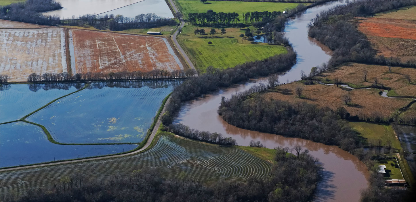
CHENIER PLAIN OF TEXAS AND LOUISIANA
The Chenier Plain region – stretching from Galveston Bay, Texas to Vermilion Bay, Louisiana – provides countless examples of managing land for the mutual benefit of agricultural producers and wildlife. Coastal wetlands provide storm surge protection to the inland farms that produce rice, crawfish, and cattle. Ricelands, with their levees and water control systems already in place, can be managed to provide significant habitat to waterfowl and shorebirds. With the impact of erosion and sea level rise on coastal marshes, managed ricelands have become increasingly important to waterbirds. Rice farms themselves are facing a rising risk of land use conversion, and wildlife conservation income –hunting leases, financial assistance programs, and working lands easements – can help these producers stay in business.
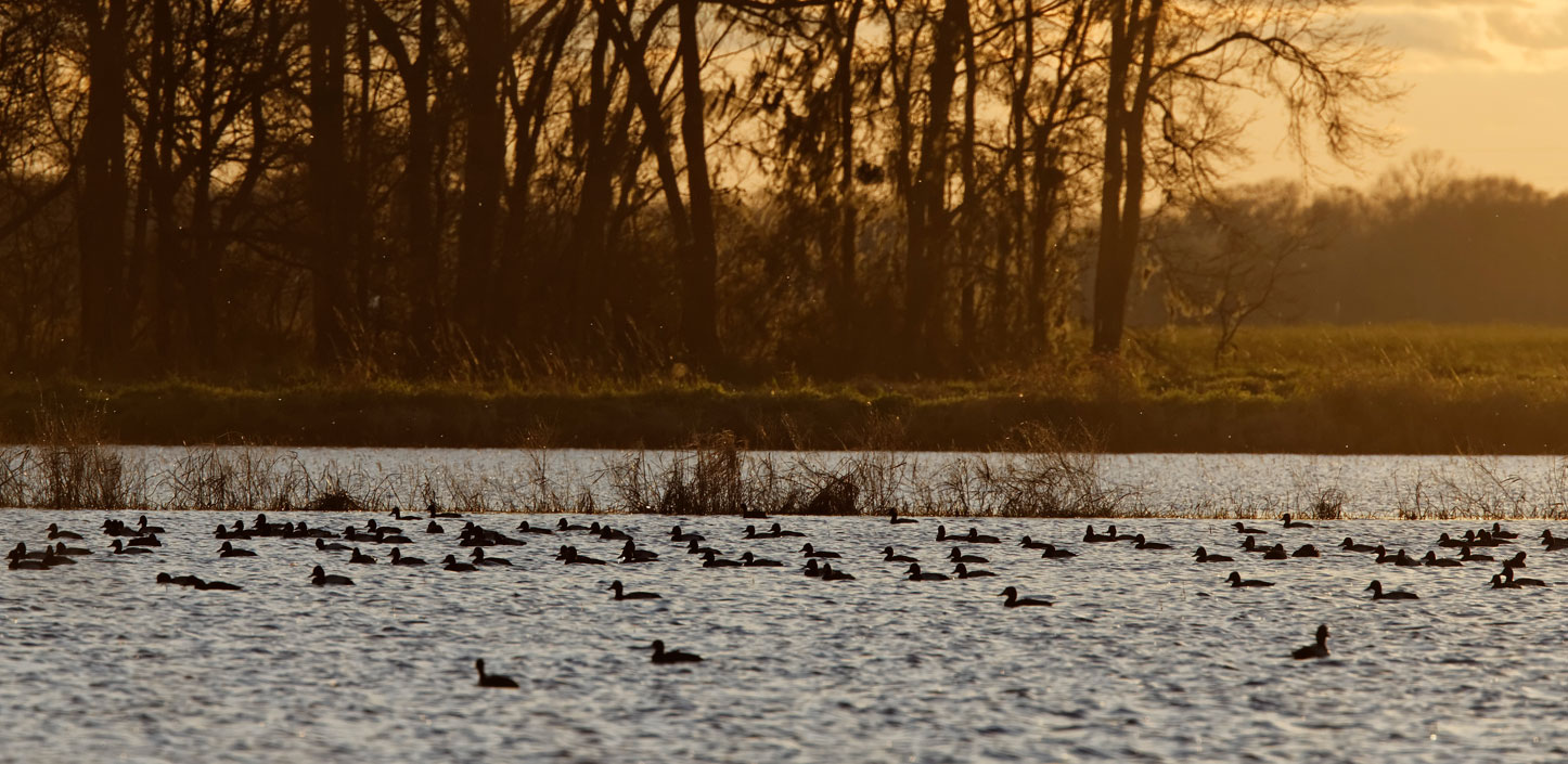
Supporting the work of groups like Ducks Unlimited through MBHI, EQIP, ACEP and GEBF, together NFWF and NRCS have enhanced over 72,000 acres of rice and coastal wetland habitat with over $6.5 million in new funding. The partnership is also permanently protecting an additional 5,800 acres of habitat, including the first potential NRCS Agricultural Land Easement in Louisiana.
MISSISSIPPI AND ALABAMA COAST
The coastal counties of Mississippi and Alabama support a range of row crop agriculture, cattle, and timber production. Incorporating best management practices into these operations can improve water quality in downstream bays and estuaries. Increasing technical assistance capacity can also accelerate the rate conservation practices are adopted.
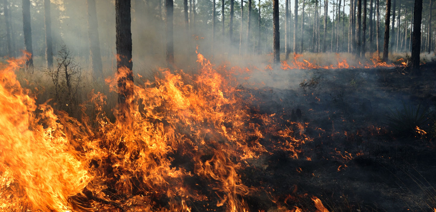
The Partnership, supporting groups like the Mississippi Land Trust and Alabama Wildlife Federation, has worked with more than 300 agricultural producers and forest landowners in the region and improved habitat management on over 90,000 acres. Our projects have also increased conservation delivery capacity in the two states – for example, by providing prescribed fire and stewardship training to over 50 veterans and underserved youth.
Through a capacity grant to the Mobile Bay National Estuary Program, NFWF funded the development of the Fowl River Watershed Management Plan in Alabama. Over 1,100 acres of ACEP wetland easements are now being enrolled through the Partnership – priority projects identified in the Fowl River management plan. The enrollments will improve water quality by excluding cattle from streams and through hydrological and bottomland hardwood restoration. This work complements other restoration projects within the Fowl River watershed.
APALACHICOLA AND SUWANNEE WATERSHEDS
Agriculture has a significant influence on the health of both of these river systems. Florida’s Apalachicola River is part of the larger Apalachicola-Chattahoochee-Flint river system, the source of over a third of the freshwater inputs to Florida’s Gulf Coast. Diminished flow from upstream consumption has negatively impacted Apalachicola Bay, which once supplied 10 percent of all U.S. oysters. The Suwannee River is one of the longest undammed river system in the Southeast, facing challenges of water quality in addition to quantity. Agricultural runoff impacts the Suwannee River itself, the underlying aquifer, and the globally significant seagrass beds near the mouth of the river.
Through voluntary, incentive-based conservation programs, NFWF, NRCS, and partners are helping agricultural producers in these watersheds improve irrigation efficiency and reduce nutrient and sediment runoff. To date, the Partnership has brought nearly $3 million in additional funds to the two watersheds and is expected to improve water quality and reduce water withdrawals through best management practices on over 7,000 acres of agricultural lands.
This work under the Partnership is complementary to the more than $45 million for other significant projects funded through GEBF, Florida Forever, and other Deepwater Horizon funding sources benefitting these two important watersheds.
SOUTHWEST FLORIDA
The Myakka watershed – which includes a designated Wild and Scenic River, an Important Bird Area, and a winter refuge for the Florida manatee – is a wilderness in the heart of a rapidly developing landscape. The river flows 66 miles, from its headwaters in rural ranch lands south to the Charlotte Harbor estuary. The Myakka watershed is a high priority for numerous conservation organizations, evidenced by an existing network of over 110,000 permanently conserved acres. The NRCS – NFWF partnership, with leadership from the Conservation Foundation of the Gulf Coast, is adding over 5,500 acres to this network through five closed or pending easements. A NFWF-funded study will guide hydrologic restoration across several adjacent properties.
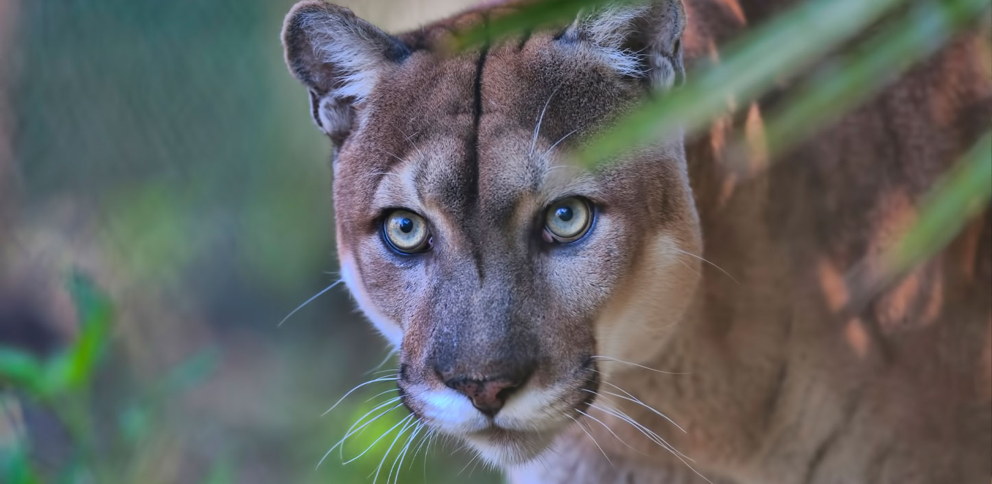
The Myakka landscape is itself part of a larger corridor envisioned to stretch all the way to the Everglades ecosystem to support population expansion of the endangered Florida panther. This Partnership, along with The Nature Conservancy and the US Fish and Wildlife Service, has acquired and restored 1,278 acres of easements along the Caloosahatchee River, a dispersal area key to panther recovery.
Looking ahead
Over the next several years, NFWF and NRCS expect to make more investments in many of the seven focal landscapes through the scheduled conclusion of the Partnership in 2023.
NFWF and NRCS are also exploring new ways to build on this successful partnership, such as including additional conservation partners, leveraging other Gulf funding sources, and expanding efforts into the forested headwaters of the Gulf Coast region.
About NFWF
Chartered by Congress in 1984, the National Fish and Wildlife Foundation (NFWF) protects and restores the nation’s fish, wildlife, plants and habitats. Working with federal, corporate and individual partners, NFWF has funded more than 5,000 organizations and generated a total conservation impact of $6.1 billion. Learn more at www.nfwf.org.